 6-Day Northern Serengeti Migration & Ngorongoro Private Safari
$2,230per person
View safari
6-Day Northern Serengeti Migration & Ngorongoro Private Safari
$2,230per person
View safari
Northern Circuit · Arusha Region
Ngorongoro Conservation Area
About Ngorongoro Conservation Area
Ngorongoro is not a national park, and the difference explains almost everything about it. It is a conservation area — a multiple-use landscape where Maasai families live, graze cattle and water livestock alongside some of the densest wildlife populations in Africa. That coexistence exists at this scale almost nowhere else on earth.
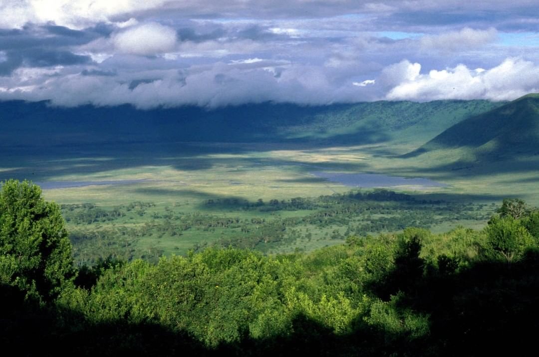
At its centre is the crater: the largest intact volcanic caldera in the world, roughly 260 square kilometres of grassland, swamp, forest and soda lake enclosed by walls six hundred metres high. Around 25,000 large animals live on the floor and most of them stay there year-round, because the walls are steep enough that there is no seasonal migration in or out for most species. That is why a single day here so often outperforms three days elsewhere, and why it is one of very few places where the traditional Big Five can be seen inside one morning.
But the conservation area is far larger than the crater, and most visitors see only the crater. It runs from the Rift Valley escarpment across the highlands and out onto the short-grass plains, taking in a set of places that would be destinations in their own right anywhere else.
Olduvai Gorge cuts through the plains on the road to the Serengeti — thirty miles of exposed, datable ash layers where the Leakeys spent decades and rewrote the human timeline. South of it, at Laetoli, a trackway of hominin footprints roughly 3.6 million years old records our ancestors walking upright. Both sit within an hour of the main road and cost a fraction of a transfer day.
North-east of the main caldera, Empakaai and Olmoti are smaller collapsed volcanoes reached on foot rather than by vehicle — Empakaai holding a flamingo-covered soda lake with Ol Doinyo Lengai standing across the Rift behind it. These are walking destinations with an armed ranger, and they are quiet in a way the crater floor no longer is.
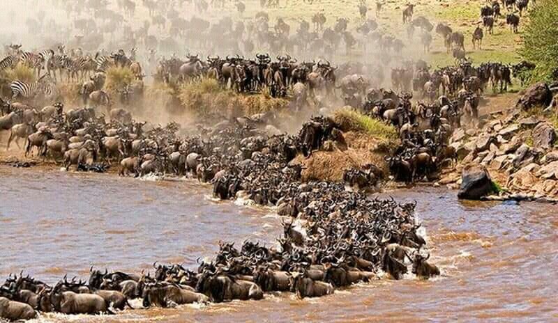
And in the far west, the conservation area takes in the Ndutu plains, shared with the southern Serengeti. From December to March the migration is here to calve, and because Ndutu lies inside the conservation area rather than the national park, off-road driving is permitted — which makes it the best photographic game viewing in northern Tanzania during those months.
The practical implication is that Ngorongoro deserves more than the single crater day most itineraries give it. Two nights on the crater rim, with one day below and one spent on Olduvai, Empakaai or the highlands, is a materially better trip for very little extra cost.
What to see here
12 places inside Ngorongoro Conservation Area worth planning around.
-
The Crater Floor #
The largest intact volcanic caldera in the world, roughly 260 square kilometres of grassland, swamp, forest and soda lake enclosed by walls six hundred metres high. It is not a park in the ordinary sense so much as a bowl with its own weather and its own permanent population of animals.
Around 25,000 large animals live on the floor, and most of them stay: the walls are steep enough that there is no seasonal migration in or out for the majority of species. That produces a density of game found nowhere else in East Africa, and it is why a single day here so often outperforms three days elsewhere.
The descent road opens at six in the morning and vehicles must be off the floor by six in the evening. Going down at opening — rather than after a leisurely breakfast — is the difference between a crater morning and a crater traffic jam, and it is the one piece of planning that matters most here.
-
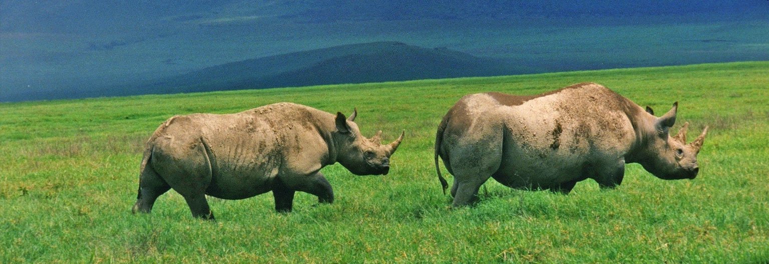
The Black Rhino of Ngorongoro #
The crater holds one of the last reliably viewable populations of black rhino in Tanzania, and for many travellers this is the only realistic chance of seeing one at all. The animals are individually known and protected around the clock, which is the only reason they are still here.
They are usually found on the open grassland of the crater floor in the early morning, often at a distance — this is a species that keeps its space, and the rangers keep vehicles at a respectful remove. A spotting scope or a long lens earns its place in the vehicle here more than anywhere else on the northern circuit.
Seeing rhino here completes the traditional Big Five in a single morning, which is genuinely unusual: lion, elephant, buffalo and leopard are all present on or around the floor, and the crater is one of very few places where all five can be seen inside one drive.
-
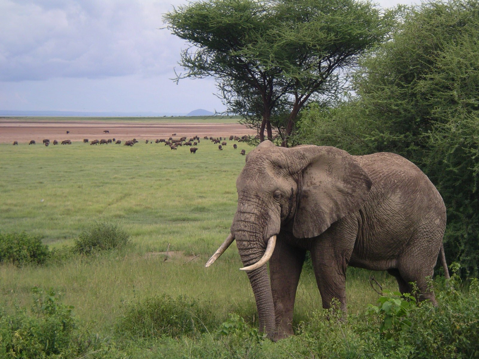
Lerai Fever Tree Forest #
A stand of yellow-barked acacia — the fever tree, named by early travellers who blamed the malaria they caught in swampy ground on the trees rather than the mosquitoes — growing on the southern floor of the crater, fed by groundwater running off the walls.
The forest is where the crater's elephants spend much of their time, and they are worth the stop for a particular reason: these are old bulls carrying some of the heaviest ivory left in East Africa. Cow-calf herds are largely absent from the floor, so what you see at Lerai tends to be a small number of very large, very relaxed individual animals.
The dappled light under the canopy makes for different photographs from the flat glare of the open floor, and the forest is also good for waterbuck, bushbuck and the crater's baboon troops.
-
Pictures coming soon We are still building this gallery.
Olduvai Gorge #
A thirty-mile ravine cut through the layered ash of the Serengeti plains, and one of the most important archaeological sites on earth. Louis and Mary Leakey worked here for decades from the 1930s, and what they found rewrote the human timeline: stone tools, and the hominin remains that established East Africa as the place our species came from.
The layers exposed in the gorge walls are legible as a sequence, each one a different period of ash and sediment, which is what makes the site so productive — you can date what you find by the layer you find it in. A small museum on the rim sets out the finds and the geology, and the view down the gorge does more to explain the place than any display case.
It sits directly on the road between Ngorongoro and the Serengeti, so it costs an hour of a transfer day rather than a day of its own.
-
Empakaai and Olmoti Craters #
Ngorongoro is the famous caldera but not the only one. Empakaai, north-east of the main crater, is a smaller collapsed volcano holding a deep soda lake that is often pink with flamingo, and its rim gives one of the best views in Tanzania: Ol Doinyo Lengai directly across the Rift, and on a clear morning Kilimanjaro far to the east.
The descent to the lake takes about forty-five minutes on foot through montane forest, and the climb back up rather longer. It must be done with an armed ranger, since buffalo use the same trail.
Olmoti, closer to the main crater, is a gentler walk to a waterfall where the Munge River drops off the crater rim. Both are walking, not driving, and both are quiet — a few vehicles a day against the hundreds on the crater floor below. For anyone who wants to be out of the car and on their feet, this is where the conservation area delivers.
-
Pictures coming soon We are still building this gallery.
Ngoitokitok Springs and the Hippo Pool #
A spring-fed pool on the eastern side of the crater floor, and the designated picnic site — which means it is the one place on the floor where you are allowed out of the vehicle, and consequently where most crater days pause around midday.
Hippo lie packed into the pool in numbers, surfacing and submerging a few metres from where people eat lunch, and the surrounding marsh draws elephant, buffalo and a constant traffic of waterbirds. The black kites overhead have learned exactly what a picnic box is, and will take a sandwich out of an unwary hand — eat inside the vehicle or under cover.
It is a working stop rather than a destination, but it is also the moment on a crater day when you stand on the floor of the caldera with the walls all around you and get a proper sense of the scale of the place.
-
Pictures coming soon We are still building this gallery.
Maasai Life on the Highlands #
Ngorongoro is not a national park, and the distinction matters. It is a conservation area, which means Maasai families live inside it, graze cattle across the highlands, and bring livestock down to water on the crater floor by day — a coexistence between pastoralists and wildlife that exists at this scale almost nowhere else.
Seeing herders moving cattle across the same grassland as zebra and wildebeest is one of the defining images of the area, and it is a live arrangement rather than a display: the grazing rights, the water access and the boundaries are negotiated and contested continually.
Village visits can be arranged, and are worth doing with clear eyes. Some are genuine, some are staged for visitors, and the difference is largely down to who takes you. We will tell you honestly which is which rather than book the convenient one.
-
Pictures coming soon We are still building this gallery.
Laetoli and the Shifting Sands #
South of Olduvai, at Laetoli, Mary Leakey's team uncovered a trail of hominin footprints pressed into volcanic ash and sealed by the next fall — three individuals walking upright, dated to roughly 3.6 million years ago. It is the oldest direct evidence of our ancestors walking on two legs, and it was made a short drive from where you are standing.
The original trackway has been reburied to protect it, so what visitors see is the site and its interpretation rather than the prints themselves. It rewards a guide who can tell the story properly.
Nearby, the Shifting Sands is a crescent dune of black volcanic ash, held together by its own magnetism, that moves across the plain at a measurable rate each year — its position is marked, so you can see how far it has travelled. Both sit off the main Serengeti road and need to be planned in rather than passed.
-
Pictures coming soon We are still building this gallery.
Lake Magadi and the Crater Flamingos #
The shallow soda lake on the floor of the crater, fed by the Munge stream off the northern wall, and the reason there are flamingos down there at all. Its size swings enormously between seasons: a broad silver sheet after the rains, a cracked white pan with a puddle in the middle by the end of a dry year.
Both lesser and greater flamingo use it, in numbers that rise and fall with the water and the algae in it. When conditions are right the far shore turns pink and the birds are audible from the track; when the lake is low they thin to a scattered few hundred. Neither state is a disappointment, but the picture people arrive expecting depends on rain that fell weeks earlier.
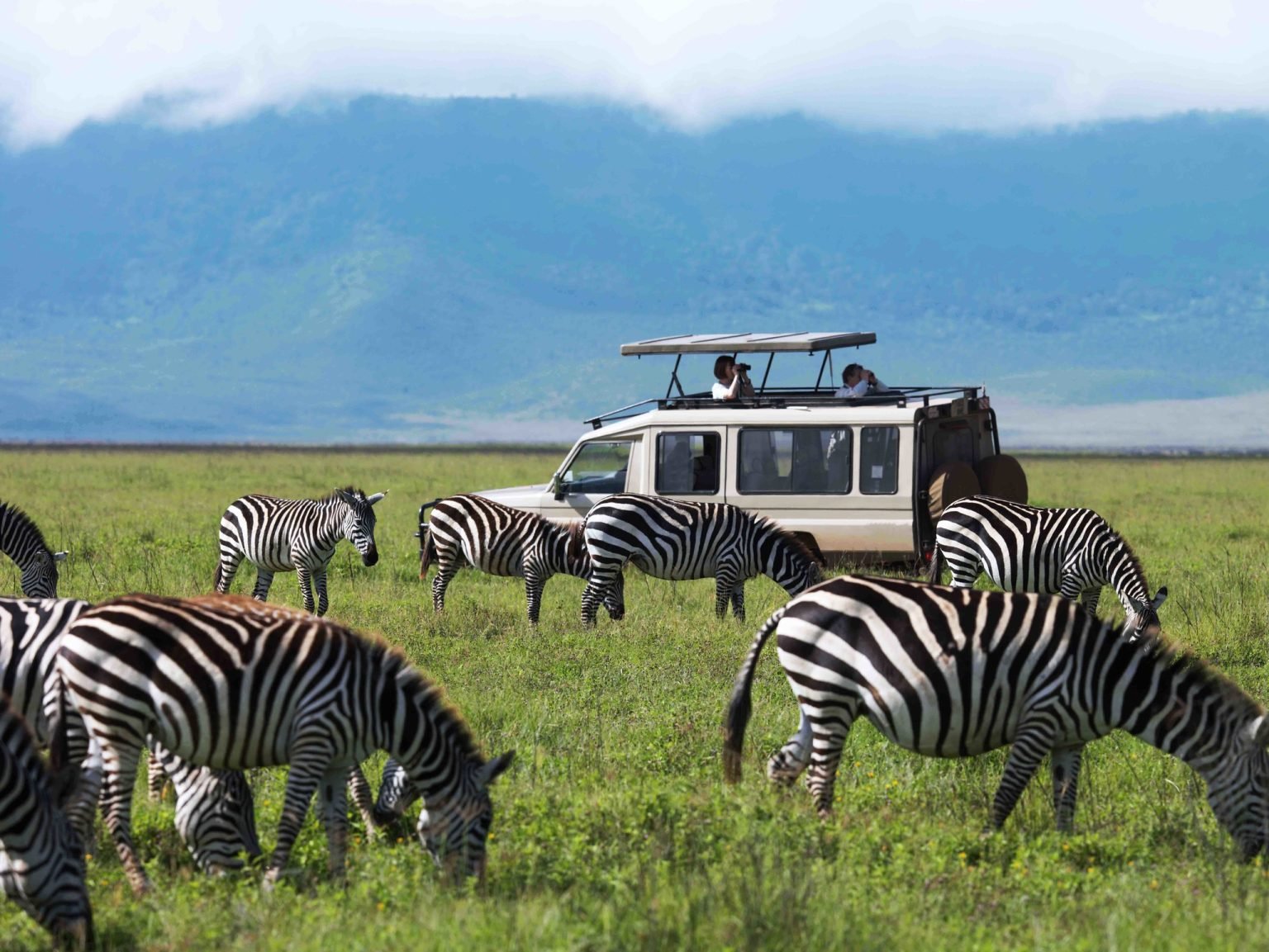
The lake edge is also where the crater game funnels through the middle of the day: zebra and wildebeest coming to the freshwater seeps around the margins, jackal working the shoreline, and the hyena clans that patrol the flats. The light coming off the water late in the afternoon is the best in the crater.
-
Pictures coming soon We are still building this gallery.
The Crater Rim and Heroes Point #
The rim road runs around the caldera at roughly 2,300 metres, through montane forest hung with lichen, and the viewpoints along it are an attraction in their own right rather than a stop on the way down.
The best known is the point near the Windy Gap where Michael and Bernhard Grzimek are buried. Their aerial survey work in the 1950s, and the book and film that came out of it, did more than anything else to establish this ecosystem as something to be protected whole; Michael died in a light aircraft crash over the plains in 1959, and the memorial looks out over the country the survey was about.
It is cold up here, and often wet, which surprises people who packed only for a safari. Buffalo and elephant move through the rim forest and are sometimes met on the road, the birding is completely different from the floor, and on a clear morning the whole caldera lies below you with the shadow of the western wall retreating across it.
-
Pictures coming soon We are still building this gallery.
Nasera Rock and the Gol Mountains #
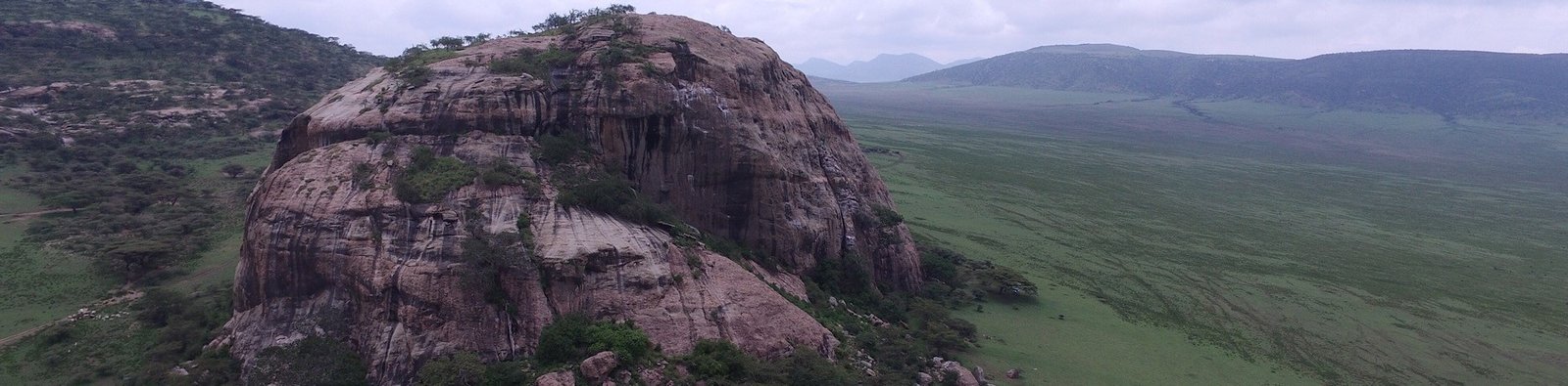
North-east of Olduvai, on the far side of the conservation area, a single block of granite stands about eighty metres out of the plain. Nasera Rock is visible for a very long way, and people have used it for as long as there have been people here.
The shelter at its base holds a Stone Age occupation sequence excavated in the 1970s, and Maasai still bring stock to the seasonal water around it. Scrambling up the back takes half an hour and puts you above the Gol Mountains and the Salei plains, with klipspringer on the ledges and resident raptors on the face.
Almost nobody comes. Reaching it means a long drive on rough tracks with a guide who knows the way, usually as a full day out of a Ndutu camp in the green season, when the plains around it hold the migration and the country is at its best. It is the most striking place in the conservation area that is not the crater itself.
-
Pictures coming soon We are still building this gallery.
Ol Karien Gorge and the Vultures #
A narrow gorge cut into the Gol Mountains, and the most important breeding site in northern Tanzania for Ruppells griffon vulture. Hundreds of pairs nest on the cliffs, and birds from these colonies range enormously: the vultures circling a kill out on the Serengeti plains have very often come from here.
Walking into the gorge with a Maasai guide takes an hour or two along the dry streambed, between walls that close in overhead and carry nests on ledges above you. Egyptian vulture, lammergeier and augur buzzard turn up on the same walk, and the noise of the colony carries a long way down the rock.
The gorge matters to the Maasai as well. It holds water when the plains have none, and it is used in ceremony, so visits are arranged through the community and the conservation area rather than simply driven to. It lies on the Ndutu and Kakesio side, which makes it part of a southern Ngorongoro itinerary rather than a crater day.
Safaris that visit Ngorongoro Conservation Area
Ready-made itineraries that include this destination. Every one can be tailored.
6-Day Northern Serengeti Migration & Ngorongoro Private Safari
$2,230per person
View safari
 Wings, Plains & Villages: 4-Day Luxury Fly-In Safari from Zanzibar
$2,800per person
View safari
Wings, Plains & Villages: 4-Day Luxury Fly-In Safari from Zanzibar
$2,800per person
View safari
 6-Day Grumeti Passage: Tarangire, Serengeti & Ngorongoro Private Safari
$2,530per person
View safari
6-Day Grumeti Passage: Tarangire, Serengeti & Ngorongoro Private Safari
$2,530per person
View safari
 6-Day Ndutu Calving Season & Ngorongoro Private Safari
$2,170per person
View safari
6-Day Ndutu Calving Season & Ngorongoro Private Safari
$2,170per person
View safari
 8-Day Serengeti Migration Seasons & Ngorongoro Private Safari
$3,025per person
View safari
8-Day Serengeti Migration Seasons & Ngorongoro Private Safari
$3,025per person
View safari
 6-Day Grumeti Passage: Tarangire, Serengeti & Ngorongoro Private Safari
$2,530per person
View safari
6-Day Grumeti Passage: Tarangire, Serengeti & Ngorongoro Private Safari
$2,530per person
View safari