
 10-Day Tanzania Rift Valley, Serengeti & Cultural Highlands Private Safari
$3,575per person
View safari
10-Day Tanzania Rift Valley, Serengeti & Cultural Highlands Private Safari
$3,575per person
View safari
Northern Rift Valley · Arusha Region
Lake Natron & Ol Doinyo Lengai
About Lake Natron & Ol Doinyo Lengai
Natron is the strangest landscape in Tanzania and the one fewest visitors reach. It sits in the Rift Valley near the Kenyan border, in country that is genuinely semi-desert, and it is reached by a rough four-wheel-drive road that should be treated as most of a day rather than a transfer.
The lake itself is barely water in any ordinary sense — a shallow soda pan fed by mineral-rich hot springs, with no outlet, in a basin where evaporation vastly exceeds inflow. The salts concentrate until the pH approaches that of ammonia and the surface can exceed fifty degrees. What lives in it are halophilic micro-organisms, and they are what turn it deep red and orange from the air. Along the edges the crust forms in geometric plates of white and pink salt that crunch underfoot.
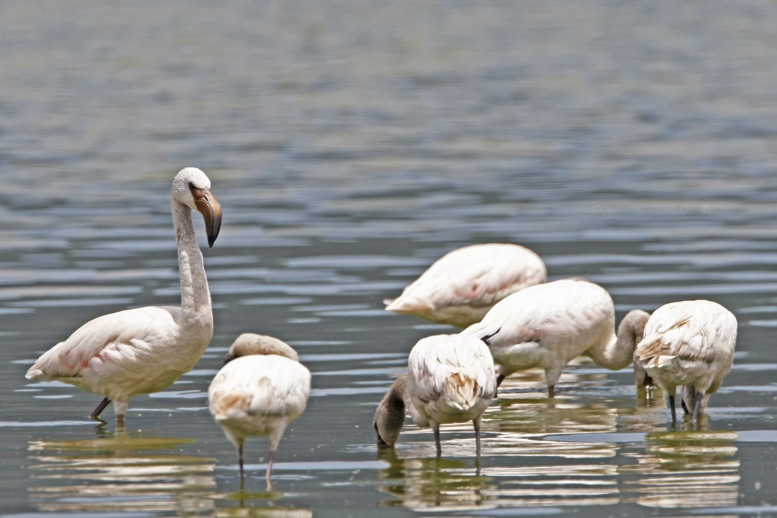
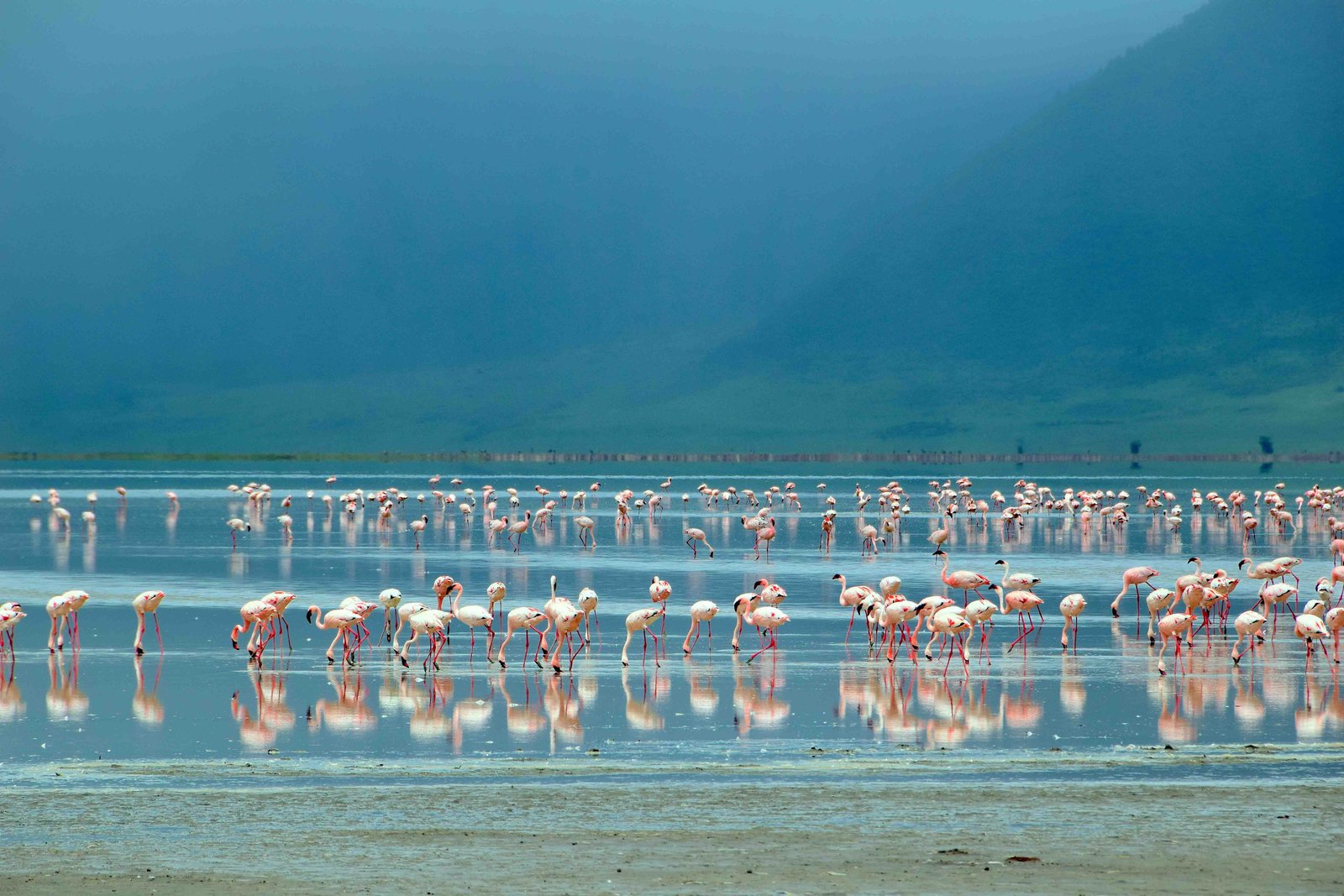
That hostility is precisely why the lake matters. Natron is the single most important breeding site for lesser flamingo in the world: the great majority of the species — the birds seen at Manyara, Nakuru, Bogoria and across the Rift — are hatched here and almost nowhere else, because nothing can reach the nests across water that would injure most animals. Breeding is not annual and depends on water levels, so the spectacle is not guaranteed in any given season; the scale of the flocks along the shoreline is.
Standing over it is Ol Doinyo Lengai, the Mountain of God in Maasai, and the only active volcano on earth erupting natrocarbonatite — a lava so unusual it emerges black and comparatively cool, then weathers to white within weeks, so the upper slopes look snow-covered in equatorial heat. It can be climbed, and it is hard: groups leave around midnight to summit at dawn and get off the exposed upper mountain before the sun, with roughly 1,600 metres of ascent on loose ash at gradients that have people using their hands.
The area also holds two things almost no visitor to Tanzania has heard of. A gorge behind the village leads up to waterfalls and cold pools, an hour's wade and scramble from one of the hottest inhabited places in the country. And on a hardened ash flat nearby lies the largest assemblage of ancient human footprints in Africa — hundreds of prints from dozens of individuals, preserved in volcanic mud from Lengai itself, recording a single afternoon somewhere between five and nineteen thousand years ago.
Natron is not a park. It is Maasai land, and everything a visitor does here is arranged through the communities who hold it, with fees going to them rather than to a national agency. Most itineraries treat it as an out-and-back detour; it does not have to be, since a rough track runs on from here into the northern Serengeti and turns the detour into a link.
What to see here
12 places inside Lake Natron & Ol Doinyo Lengai worth planning around.
-
The Flamingo Breeding Grounds #
Lake Natron is the single most important breeding site for lesser flamingo in the world. The great majority of the species — the birds seen at Manyara, Nakuru, Bogoria and across the Rift — are hatched here, and almost nowhere else.
The reason is the water itself. Natron is so alkaline and so hot that almost nothing can survive in it, which means no predators can reach the nests. The birds build cones of mud out on the salt flats and raise chicks in conditions that would injure most animals, protected by the hostility of the place.
Breeding is not annual and depends on water levels, so the spectacle is not guaranteed in any given season. What is constant is scale: flocks of tens of thousands strung along the shoreline in a shimmer of heat, with a volcano behind them. Nesting areas are kept at a distance and should be — disturbance here has consequences for the whole species.
-
Pictures coming soon We are still building this gallery.
Ol Doinyo Lengai #
The Mountain of God in Maasai, and the only active volcano on earth that erupts natrocarbonatite — a lava so unusual it comes out black and comparatively cool, then weathers to white within weeks, so the upper slopes look snow-covered in equatorial heat.
It can be climbed, and the climb is genuinely hard. Groups leave around midnight to reach the summit at dawn and to be off the exposed upper mountain before the sun is up; the ascent is around 1,600 metres on loose ash and steep scree at gradients that have people using their hands. It is short in distance and severe in effort, and it defeats a fair number of fit people.
What you get at the top is the active crater with steaming hornitos, the Rift laid out below, and on a clear morning the Serengeti plains on one side and Kilimanjaro on the other. Conditions change; the mountain is genuinely active and climbing is subject to its behaviour.
-
Pictures coming soon We are still building this gallery.
The Engare Sero Waterfalls #
A short distance from the lake, a stream running off the Rift escarpment has cut a gorge into the rock, and walking up it leads to a series of falls dropping into clear pools.
The walk is the appeal as much as the destination. You go up the streambed itself with a local Maasai guide, wading and scrambling between narrow walls, out of the sun for the first time since arriving in one of the hottest inhabited places in Tanzania. It takes about an hour each way, and the water at the top is cold and deep enough to swim.
The contrast is what people remember. Natron is a punishing landscape — salt, dust, heat that sits above forty degrees for much of the year — and half an hour after leaving it you are standing under a waterfall in a green slot canyon. Guides are arranged through the village, and the fee goes to the community that manages the site.
-
Pictures coming soon We are still building this gallery.
The Engare Sero Footprints #
In 2006 a Maasai guide led researchers to a hardened ash flat near the village that turned out to hold the largest assemblage of ancient human footprints in Africa — hundreds of prints, made by dozens of individuals, preserved in volcanic mud from Ol Doinyo Lengai and dated to somewhere in the range of five to nineteen thousand years ago.
They are modern human, not hominin, and that is what makes them extraordinary in a different way from Laetoli. You can read behaviour in them: a group moving together, some running, one individual with a damaged foot, the whole thing a single afternoon frozen in ash.
The site is protected and visited with a local guide. It is not a museum and there is little infrastructure — you are standing on the surface people crossed, with the volcano that buried their tracks standing behind you. Very few visitors to Tanzania have heard of it.
-
Pictures coming soon We are still building this gallery.
The Rift Valley Escarpment Drive #
The road from the Ngorongoro highlands down to Natron is a destination in itself, and one of the most dramatic drives in East Africa.
It drops off the forested crater highlands, through the Rift wall, into country that gets progressively drier and hotter until it is genuine semi-desert, with the escarpment rising thousands of feet on one side and the valley floor running north towards Kenya on the other. Maasai bomas, goat herds and cattle being walked to water are the traffic.
It is rough — this is a slow, corrugated, four-wheel-drive road, and it should be treated as most of a day rather than a transfer. That is also the reason Natron stays quiet: the journey filters out anyone in a hurry. Coming from the Serengeti side, the same route links Natron to the northern parks without doubling back through Karatu.
-
Pictures coming soon We are still building this gallery.
The Soda Shore #
The lake itself is barely water in any ordinary sense. It is a shallow soda pan fed by mineral-rich hot springs, with no outlet, in a basin where evaporation vastly exceeds inflow — so the salts concentrate until the pH approaches that of ammonia and the surface temperature can exceed fifty degrees.
What grows in it are halophilic micro-organisms, and they are what turn the water deep red and orange from the air. Along the edges the crust forms in geometric plates and ridges of white and pink salt that crunch underfoot, and the whole flat shimmers hard enough that the far shore appears to float.
Walking out onto it with a guide, early in the morning before the heat becomes dangerous, is genuinely otherworldly — closer to a photograph of another planet than anywhere else in the country. It is also fragile, hot and easy to misjudge, which is why it is not done alone.
-
Pictures coming soon We are still building this gallery.
Maasai Life in the Natron Basin #
Natron is not a park and it is not empty. It is Maasai land, grazed and lived on, and everything a visitor does here — the waterfall, the footprints, the walk onto the flats, the climb up Lengai — is arranged through the communities who hold it.
That produces a different kind of visit from a national park. Your guide up the gorge is from the village at the bottom of it; the fees paid go to the community rather than to a national agency; and the herding, watering and moving of livestock through some of the harshest inhabited country in East Africa is happening around you rather than being shown to you.
Boma visits can be arranged and are worth doing here more than in most places, precisely because the arrangement is not built around tourism. Ol Doinyo Lengai is a sacred mountain in Maasai belief, and hearing what it means from someone who lives beneath it changes the climb.
-
Pictures coming soon We are still building this gallery.
The Northern Route to the Serengeti #
Most itineraries treat Natron as an out-and-back detour from Arusha, which costs two long driving days. It does not have to be.
A rough track runs west and north from Natron into the Serengeti ecosystem, entering the park through its remote northern sections rather than through the main Naabi gate. Taking it turns the detour into a link, and it puts you into the northern Serengeti — the Mara River country — from a direction almost nobody arrives from.
It is a demanding drive on poor roads and needs a properly equipped vehicle, a guide who has done it, and a day given over to it. For travellers who want the crossings in season and want Natron as well, it is by some distance the best way to combine them, and the country in between is empty in a way the rest of the northern circuit no longer is.
-
Pictures coming soon We are still building this gallery.
The Volcanic Skyline #
Lengai is the active one, but it is not alone. The Natron basin is ringed by volcanoes, and learning to name them changes the drive: Kerimasi standing immediately south of Lengai, extinct and forested at the top; Gelai, a huge shield rising off the eastern shore of the lake; Kitumbeine and Ketumbeine further east; and the wall of the Rift escarpment closing the west.
Kerimasi is the interesting one geologically. It erupted the same strange carbonatite chemistry as Lengai in its time, and the ash and tuff it laid down are what the Engare Sero footprints are preserved in, so the mountain that buried those tracks is standing in the picture.
None of these are climbs for a normal itinerary, but the skyline they make is the reason photographs of this place look unlike anywhere else in Tanzania. Late afternoon from the western shore, with Gelai across the water and Lengai to the south, is the view the basin is worth coming for even if you never leave the vehicle.
-
Pictures coming soon We are still building this gallery.
Dawn on the Salt Flats #
The lake has one hour a day when it is comfortable to be near, and it is the hour after first light. Walking out towards the water with a guide before the sun is properly up, while the crust is still cool and the air still moves, is the way this place should be seen.
At that hour the flats are a mirror. A film of water lies over the salt, the volcanoes stand reflected in it, and flamingos work the shallows in lines that break the surface into ripples of pink. Photographers plan whole trips around it, and it is why so many pictures of Natron look like they were taken from the air when they were taken from the ground.
By nine it is over. The heat comes up, the mirage takes the far shore apart, and the crust becomes genuinely dangerous to walk on: the water is caustic, it is hot enough to burn, and it is deeper than it looks in places. Nobody should go out there alone or later in the day, and the villages provide the guides who know which line to take.
-
Pictures coming soon We are still building this gallery.
The Sonjo and the Escarpment Springs #
The Natron basin is Maasai country, but it is not only Maasai. On the escarpment to the west, at Samunge and the villages around it, live the Sonjo, a farming people who have been there far longer, growing crops on terraces around springs in the middle of a semi-desert.
Their villages are the practical reason the road north to the Serengeti is passable at all, and they are worth stopping in. Sonjo settlements were traditionally built for defence, tightly clustered and walled, and the irrigation systems that feed the fields are old and community-managed. The contrast with the herding country a few kilometres away is complete: one people moving cattle across an enormous landscape, another farming intensively on a few hillsides of it.
Visits are informal and arranged locally rather than packaged, which suits the place. Samunge became briefly famous nationally when a retired pastor there began dispensing a herbal cure in 2011 and drew tens of thousands of people up that road; the traffic has gone, and the village is quiet again.
-
Pictures coming soon We are still building this gallery.
Nights and Stars in the Rift #
Natron is one of the darkest inhabited places in northern Tanzania. There is no grid power in the basin, no town within a hundred kilometres, and no cloud for much of the year, which produces night skies that stop people in the middle of a sentence.
The camps here are simple by design: canvas, bucket showers, solar lamps, dinner outside. Nobody sleeps indoors in the hot months because nobody wants to, and beds are often moved onto the ground outside where the air moves. The Milky Way sits directly overhead in the dry season, and the silhouette of Lengai against it is the reason a good many photographers come.
It is also the practical shape of a visit. Days here are organised around the heat: the flats or the waterfall early, several hours doing nothing at all in the shade, then the escarpment or the shoreline in the late afternoon, then a long evening. Two nights is right. One means driving in, doing one thing exhausted, and driving out.
Safaris that visit Lake Natron & Ol Doinyo Lengai
Ready-made itineraries that include this destination. Every one can be tailored.
10-Day Tanzania Rift Valley, Serengeti & Cultural Highlands Private Safari
$3,575per person
View safari
 Flamingos & Great Herds: 7-Day Private Tanzania Safari
$2,970per person
View safari
Beyond the Circuit: 10-Day Private Tanzania Safari - Volcanoes, Soda Lakes and Ancient Cultures
$4,461per person
View safari
Flamingos & Great Herds: 7-Day Private Tanzania Safari
$2,970per person
View safari
Beyond the Circuit: 10-Day Private Tanzania Safari - Volcanoes, Soda Lakes and Ancient Cultures
$4,461per person
View safari